TerraPlot™ Intelligent MappingPush the boundaries with location intelligence.
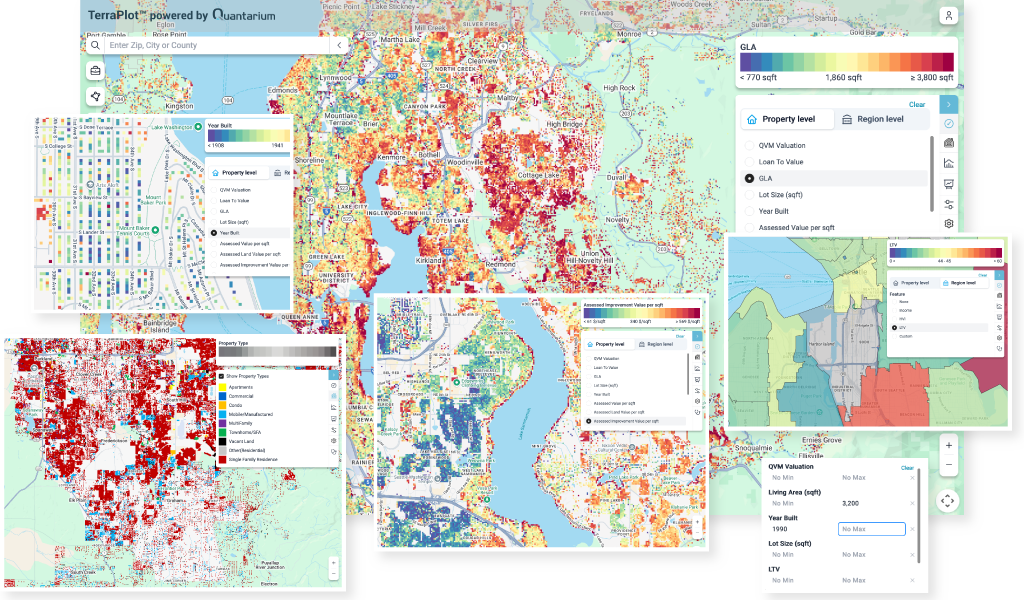
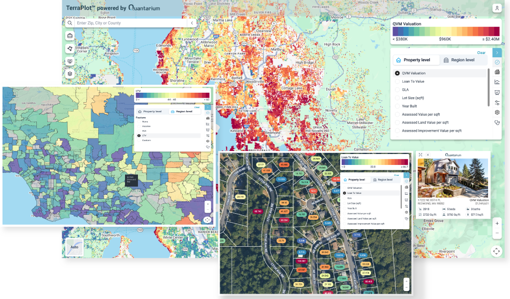
market exploration technologyDiscover Your Real Estate UniverseTerraPlot™, a novel Terraverse™ solution, facilitates live market explorations via a rich, responsive and visually driven UI.
Unparalleled layers of innovation.
Unparalleled layers
of innovation.
Adaptive Visual Encoding
TerraPlot™ delivers ultra-responsive, viewport-dependent color schematics, dynamically recalibrated on the fly using a high-throughput, multi-threaded geospatial compute stack.
Advanced Geospatial Data Mining
TerraPlot™ deploys high velocity spatial indexing of 100M+ parcel geometries (patent pending) with a rich array of minable property attributes, producing a deeply interactive and customizable user experience.
Flexible Use of Client Data
TerraPlot™ can be algorithmically trained on proprietary datasets, enabling precision-tuned map layers that reflect your unique domain intelligence and business context.
Fully Scalable, Low-Latency Architecture
Designed for national-scale deployment, the TerraPlot™ engine supports real-time high-frequency overlay rendering across granular geographic pivots and zoom levels—without compromising performance.
The power to unveil a neighborhood's DNA.
The power to unveil
a neighborhood's DNA.
Intelligent Mapping
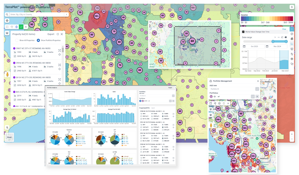
Leveraging either Quantarium’s award-winning AI-enhanced data lake or client-supplied datasets, TerraPlot™ serves interactive real-time map representations of customizable property/region-level, lat/long point and accumulated polygons data, custom layers and more. It also provides comprehensive ready-to-consume reports for any US residential property.
Advanced Valuation
TerraPlot™ employs Quantarium’s best-in-class Fitch-rated AVM and TerraIndex™ market velocity HPI to deliver real-time valuation data and actionable insights aggregated at multiple granularities, from street level, to lat/long point data, to market definition geo-polygons. TerraPlot™ can use its valuation data as salient filter pivots in custom formulas and analytics.
Temporal Mapping
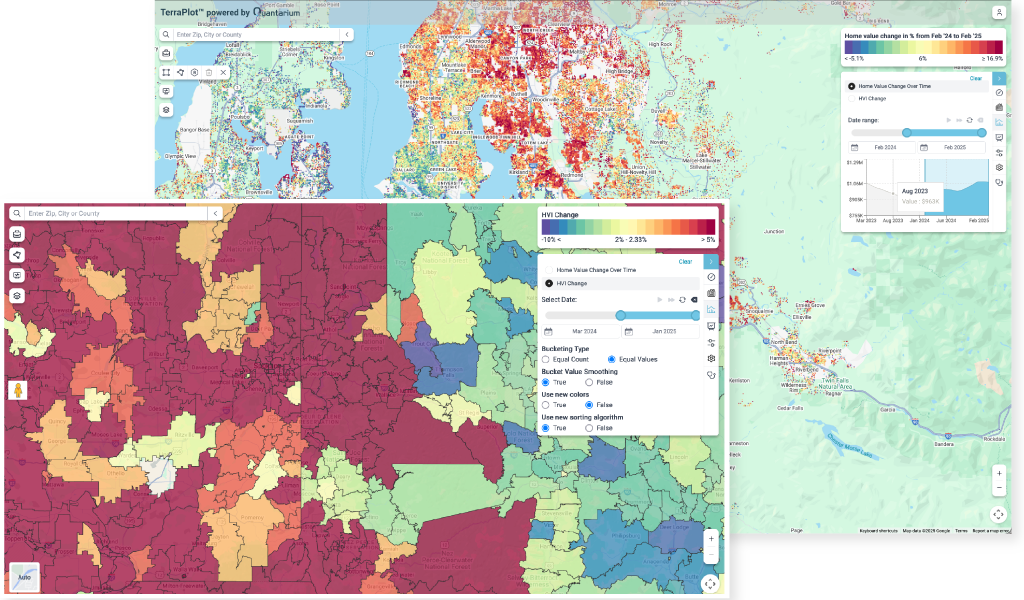
TerraPlot™’s proprietary market exploration and analysis technology enables the computation and mapping of time series for any time-referenced data, including valuation. The resulting temporal data can be examined interactively or displayed in the form of a time series animation, and is available as point data or summative geo-polygons.
Hyper-Local Market Exploration
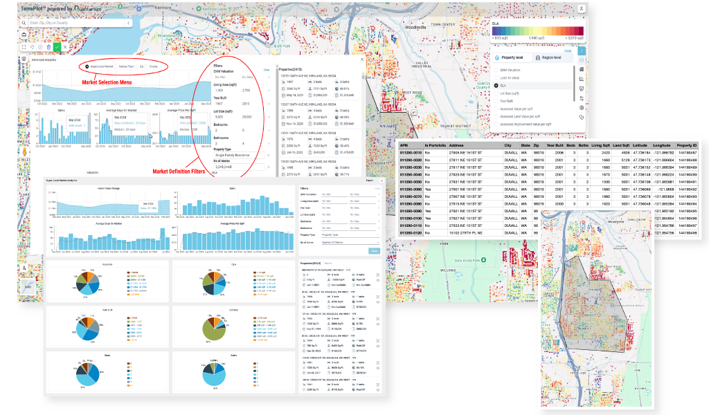
TerraPlot™ allows the definition of hyper-local subject markets using rectangle, custom polygon, geo-polygon, or similarity characteristics auto-polygon selection, and provides analytics tools for in-depth analysis and export of specially delineated market data. With built-in TerraIndex™ HPI technology, TerraPlot™ offers both hyper-localized fidelity and HPI recency.
Portfolio Management
TerraPlot™ allows the creation of custom portfolios within TerraLake™, Quantarium’s industry-leading national managed residential dataset, or the import of any definable client-supplied portfolio information. Additionally, TerraPlot™ provides powerful management tools to monitor portfolios, extract analytics, derive unique insights, and enable in-depth analyses.
Custom Special Maps
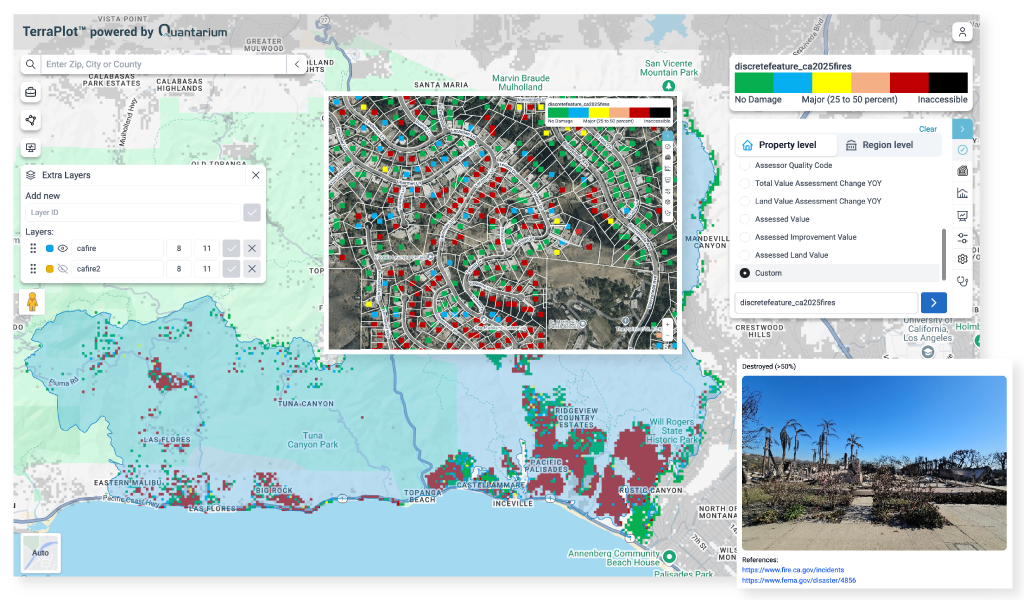
TerraPlot™ can help address a multitude of client-specific needs through the use of custom mapping pivots or map layers. As a versatile direct-to-user tool, it is able to integrate custom data or import client-provided information to generate custom maps or custom analysis vectors, facilitating the deep profiling of a subject property’s market to an unprecedented degree.
Delineate your region, rule your market.
Delineate your region,
rule your market.
Market Definition Polygon
Help appraisers unfamiliar with assigned areas outline a market-definition polygon while choosing from among salient data pivots to define best market similarity fits, such as total valuation bands, in-kind stories, builder quality codes, year-over-year appreciation, property age or views, etc.
Subject Property Fit
Assist an appraiser in determining how the subject property fits within the geographic market area. Is it homogeneous or heterogeneous to the contiguous market ? Is it an outlier high-value property in a mid-tier neighborhood?
Advanced Algorithms
Benefit from the industry’s leading precision and coverage AVM to algorithmically define contiguous areas of properties that are a similar fit in a certain regard, for example desirability or demand.
Market Exploration
Leverage TerraPlot™ market exploration technology to serve as a direct-to-customer market exploration tool, to define and illuminate areas of interest for a buyer, or to discover similar areas in distinct geographies.

